I tool the camera out a couple of weeks later to fill in some gaps. It was a day of many close encounters with kangaroos. I've added some of the photos from the second series into this post.
I start from home heading along our street, turn left onto Boddington Crescent and head towards Kambah Village.

Crossing Drakeford Drive is often a challenge. Yes, there are traffic lights but the wait can seem excessive at times.
The target, Mt Taylor, can be seen in the background.

Lanes are common throughout the suburb and this lane connects Marconi Crescent to an underpass at Sulwood Drive

The underpass is fine except following rain. Its drains clog up and the underpass becomes a pool. When filled with water there is no option but to go across Sulwood Drive which can be a bit tricky at this point.

Once through the underpass, a rough track runs alongside the houses leading up to Colquhoun Street.

Crossing Colquhoun Street you pass through an open grassy area. Mt Taylor can be seen in the distance.

Finally you reach the entrance to the park. Note the locked gate which you need to get through to enter the park.
The distance from home to the gate is 2km by the route I normally walk.

Through the gate you are on the Old Kambah Fire Trail, seen on the left of this photo. At this point I generally take the track leading off to the right as I tend to do the circuit in an anti-clockwise direction.

The park has recovered well from the 2003 bushfires which raged through it. The trees have rebounded and new trees have grown to replace those which were destroyed.
A short distance along the track there is a fork. When doing a circuit I take the track to the right. The track to the left meanders across meadows and eventually meets up with the Western Powerlines Fire Trail. I take the left track if I am climbing the mountain up "my track".

There are quite a few watercourses that run through the park. Most are dry pretty much all of the time. This creek crossing is a little over a metre deep. Not one to cross if it is full of water.

The track weaves its way across a meadow with some impressive native grasses.

At this stage I am tracking along the southern side of Mt Taylor along the Sulwood Fire Trail.

Sulwood Drive is visible at the bottom of the photo below. In the middle of the photo are a number of layers of ranges. Depending on the time of day and the light it is possible to see 5 or more ranges off in the distance.

At points on the circuit you are faced with options. I usually take the track which swings around to the left along drain.


This trail takes me up and across the bottom of a "rock run". I keep hoping to see water pouring down the rocks but to date the best I have managed is a trickle.

Water does collect in some of the rock basins.

The next shot shows the track leading up from the rock run. It is quite steep and rocky with a covering of loose soil.

The Sulwood Fire trail has some great views across Lake Tuggeranong to the town centre and the ranges beyond.

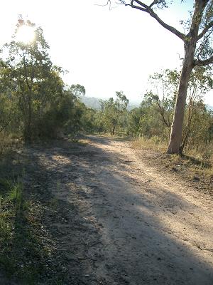
The Sulwood Fire Trail meanders up and down. It is great for developing your stabilisers and the surface is uneven, sometimes slippery and in parts rocky.


The Sulwood Fire Trail eventually meets Mrs Lowe's Fire Trail. I have no idea who Mrs Lowe is or was nor why she warrants a fire trail named after her.

If you look very carefully you can see a group of kangaroos on the path.


The intersection of the Sulwood and Mrs Low's Fire Trails

At the top of Mrs Low's Fire Trail there is a path that heads up the mountain. Trevor and I generally refer to this trail as the Mannheim Street track as it is the track that you get to from the (informal) parking area on Sulwood Drive opposite the Mannheim intersection.
There is a park noticeboard at this point and the distance from the entrance gate to the notice board is 2km.

When doing a circuit I follow the track around the fenceline, go over a culvert and pick up a track on the bank of the cut-off drain which runs inside the park. There is another track on the outside of the park and you can see people walking along it in the photo.

As can be seen in the photo above, the track is not exactly straight neither is is level. It does take a bit of care to walk along it. Good for the stabilisers! This track runs along the eastern side of the mountain.
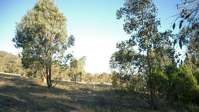
Across the drain is a fairly large meadow and there are often roos in this area.

The houses backing on to the park were built in the late 60s and early 70s. The blocks are quite large by modern standards and many of the houses boast tennis courts in their backyards. It is rare to see people out on the courts these days however I suspect that they were well used in the 70s. When I arrived in Canberra in 1972 tennis was a very common social activity.

There are some lovely views from this part of the track. The photo below has the Woden town centre with a view across to Black Mountain.


Often when out walking I come across ant nests. Here is one that I regularly pass over just beyond the bridge shown in the previous photo.

In the older suburbs the houses and other buildings are well hidden by mature trees. This view is looking over the Woden Valley with hardly a rooftop, let alone an building, to be seen over the trees.

At the point where I turn along the northern side of the park there is a rough exit path out to Macfarlane Crescent. I use this path when I am going to or returning from Woden.

Ignoring the path shown above, the path heads up over a rocky knoll before heading down towards the only official carpark servicing the park. This section of the track is rocky and rough and requires a bit of attention to foot placement.

Once through the short rocky section the path becomes flat and sandy with just the odd exposed rock jutting out to catch the unwary.

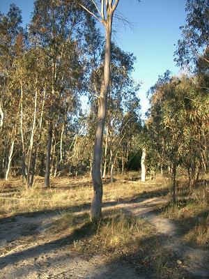
The track meanders through some light scrub before emerging near the car park. There are a number of picnic tables in this area. I don't know how well they are used as I have rarely seen anyone using them.

As indicated earlier, there are lots of options when choosing paths through the park. From the carpark/picnic area I generally follow a track along the fence and then turn along a track that leads away from an access gate. This track cross a fire trail which goes up to the summit. Crossing the fire trail I walk down an eroded track which takes me to a dry creek. I have only seen water running in this creek once. The banks of the creek are well grassed and there is a meadow on the far side of the creek which often has a small group of kangaroos in residence.

There are some lovely mature trees within the park. Here is an example of one of them.

Leaving the dry creek I continue along a track that eventually crosses the Western Powerlines Fire Trail and I join the Old Kambah Fire Trail. Below is a shot of the Western Powerlines Fire Trail looking south.The trail actually does a number of ups and downs which cannot be easily seen in the photo.

The Old Kambah Fire trail continues west before turning south. This track has wonderful views across the ranges.Once it turns south it provides good view to the west and the sunsets are often magical.
There is often a sizable group of kangaroos either above or below this section of the track. Sometimes above and below. Mostly the roos are unfazed by my passage and will either continue eating or just watch me as I pass.

The are some great example of older trees along this part of the track, too.

Below is a view across the ranges.

The following 5 photos were taken in the second series and show some of the light effects close on sunset.


Looking up towards the summit a group of kangaroos can be seen in the meadow.


And finally, the exit. This is a welcome sight when doing a late afternoon walk and the light has faded before finishing the circuit.

The circuit of the mountain is around 5.5km. Add the 2km to and from the entrance adds up to 9.5km.
If you would like to learn more about Mt Taylor here is a link
http://en.wikipedia.org/wiki/Mount_Taylor_%28Australian_Capital_Territory%29 or just put Mt Taylor ACT into your search engine.
I'll add more Mt Taylor photos when I get a chance.
The Golden Everlasting is a feature of the park. Its flowers can be seen year round.

Here is a plant in situ


